
Checks
Deprivation by postcode and census data by area
See deprivation, tenure, age and work for the people and homes within 1 km of the site, from open census data.
In short
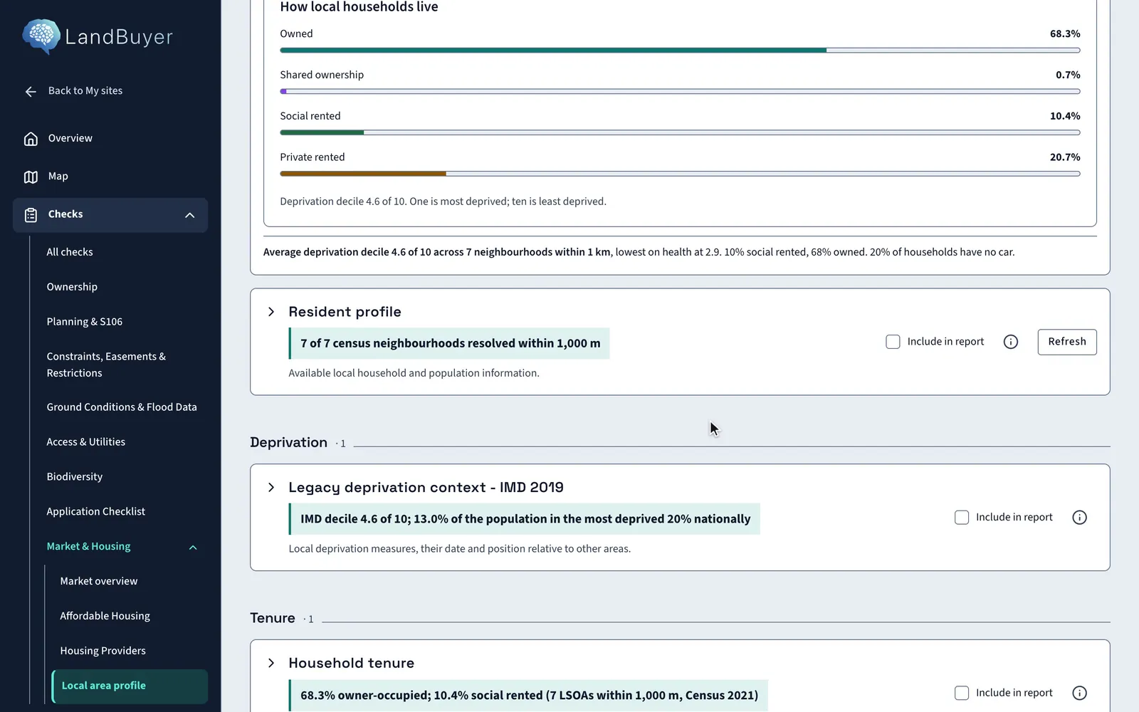
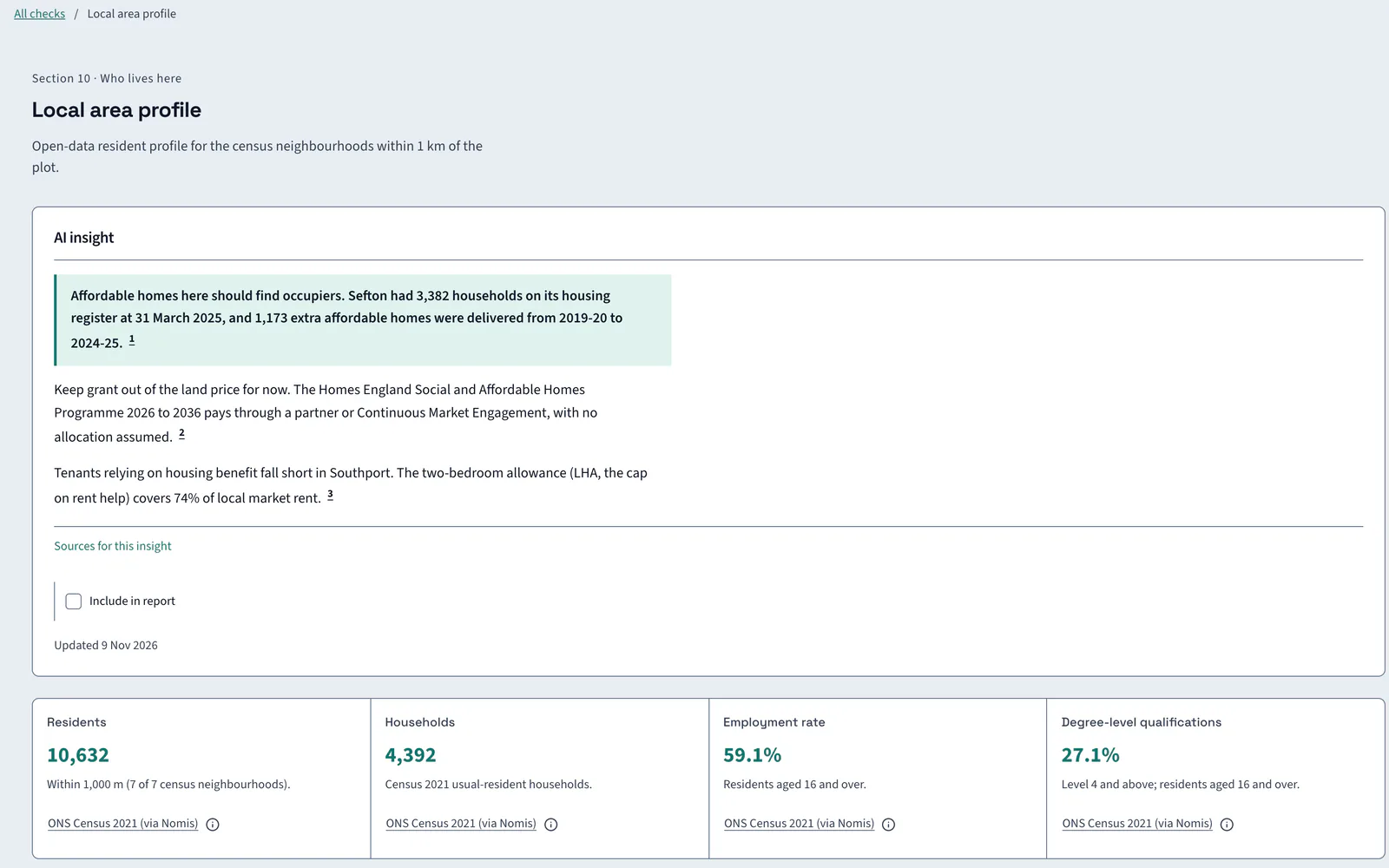
LandBuyer AI builds a resident profile for the census neighbourhoods within 1 km of the site: residents, households, tenure, deprivation, age, employment and car access. It sets housing need beside the profile. On Kew Yard it finds 10,632 residents in 4,392 households across 7 neighbourhoods.
What it covers
What our neighbourhood profile covers
| Item | Source type | What you see |
|---|---|---|
| Residents and households | Census 2021 | Residents and usual-resident households across the census neighbourhoods within 1 km |
| Household tenure | Census 2021 | Owned, shared ownership, social rented and private rented shares |
| Deprivation | Index of multiple deprivation | The average decile from 1 (most deprived) to 10, and the share of residents in the most deprived 20% nationally |
| Age profile | Census 2021 | The share of residents aged 25 to 49 and aged 65 and over |
| Employment | Census 2021 | The employment rate for residents aged 16 and over |
| Qualifications | Census 2021 | The share of residents with degree level qualifications or above |
| Car access | Census 2021 | The share of households with no car or van |
| Household classification | Census 2021 | The households counted and the neighbourhoods resolved within 1 km |
| Housing need | Housing register statistics | Households on the register at the latest date, shown beside the profile |
Official guidance English Indices of Deprivation 2025Welsh Index of Multiple Deprivation 2025ONS custom area profiles
On Kew Yard
Who lives within 1 km of Kew Yard
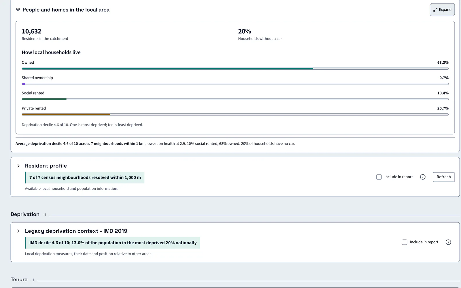
The 1 km catchment holds 10,632 residents in 4,392 households. 68.3% of households own their home.
AI insight
Sefton records 3,382 households on the register at 31 March 2025. Forward affordable land supply and current shortfall are not established by these statistics, so the register indicates need but does not size the affordable case.
In the report
The profile goes into the report with its census year
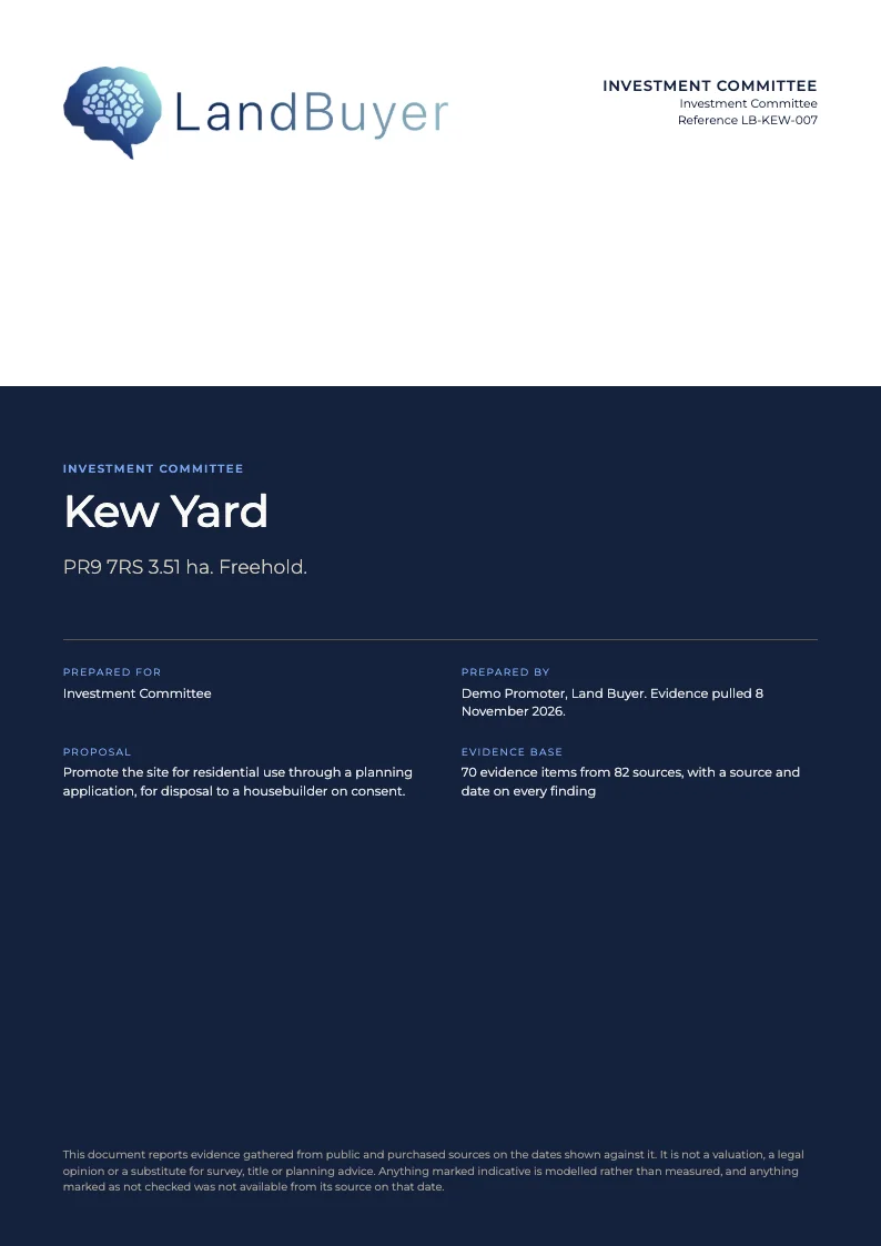
Tick Include in report on the resident profile or the tenure card. The figures and the AI reading go into the investment committee paper, with the census year beside each one.
FAQ
Deprivation and census data questions
Short answers to what land teams ask us before a demo.
What is a neighbourhood profile?
It is a resident profile for the census neighbourhoods within 1 km of the site: people, households, tenure, deprivation, work and age. LandBuyer AI draws it from open data and sets housing need beside it.
Where does the data come from?
Census 2021 supplies people, households, tenure, work and age. The index of multiple deprivation supplies deprivation. Both are open data, and each card shows its source and date.
How do I find household tenure or deprivation by postcode?
Start from the site's postcode or red line. LandBuyer AI resolves the census neighbourhoods within 1 km and reports tenure and deprivation across all of them. On Kew Yard that is 7 neighbourhoods.
Can I compare one neighbourhood with the borough?
Yes. Tenure is compared for the nearest census neighbourhood, the borough and England. Near Kew Yard, 60% of households own, 20% rent social and 20% rent privately.
How is deprivation measured?
In England, by the English Indices of Deprivation 2025, published by the Ministry of Housing, Communities and Local Government in October 2025. In Wales, by the Welsh Index of Multiple Deprivation 2025.
Keep exploring