
Features
A land intelligence platform, end to end
From a red line on the map to the report your committee reads.
In short
LandBuyer AI is a land intelligence platform for England and Wales. It maps the land around your red line, runs every check with an AI insight, draws a constraints plan and an indicative layout from your house types, scores the site to your priorities and drafts the report your committee reads.
All features
Ten features, one workflow
Start on the land data map, read the checks and their AI insights, see the indicative layout and the site score, then draft the report. Your team, your contacts and your company settings sit around every site, so each feature works from the same evidence.
-
Land data map
A land data map around your red line: title boundaries, flood zones, buildings, water, planning and heritage layers on satellite, street or historic maps.
-
Site constraints plan
A site constraints plan drawn for you, with easements, margins, flood areas, access and services marked as constraints and opportunities for your designer.
-
AI site layout generator for housing
An AI site layout generator that places homes on your site from your own house types, after constraints, easements and access are taken out, in 2D and 3D.
-
Land due diligence reports
Draft a land due diligence report from your saved checks for each reader: land committee papers, site assessments, offer briefs and lender reports.
-
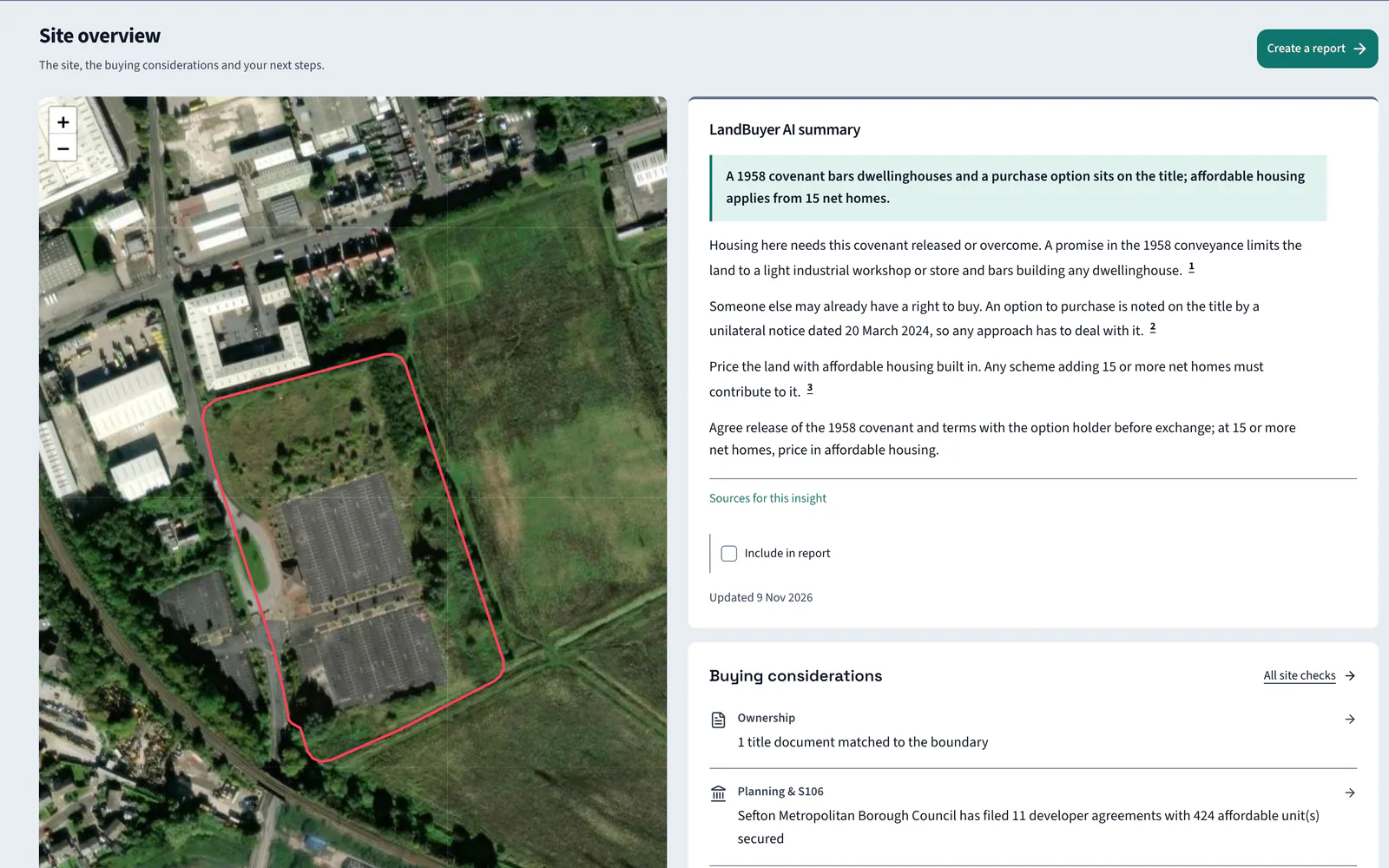
AI land intelligence on every site check
AI land intelligence on every check. Each opens with an insight naming the factor that decides viability, with numbered citations to the evidence.
-
Site scoring for land buying decisions
Site scoring out of 100, weighted to your company priorities, with module scores from weakest to strongest and a viability verdict for each site you check.
-
Land pipeline software for your team
Land pipeline software for your team: every site on one board, with notes, mentions, files and emails kept on each site and reports sent from LandBuyer AI.
-
Find landowner and site contact details
Find landowner contact details for your site alongside ward councillors, the local MP and utility operators, grouped in one list you can work through.
-
House type library and company settings
Set your house type library, site specification, report brand and scoring priorities once, and every layout, score and report on LandBuyer AI uses them.
-
Personalised land insights from day one
Personalised land insights from your first site. Onboarding sets LandBuyer AI to how your organisation reads land, with your scoring and brand kit.
FAQ
Land intelligence platform questions
Short answers to what land teams ask us before a demo.
What is a land intelligence platform?
Software that brings the land data for a site together and says what it means. LandBuyer AI goes from the map to findings, a layout, a score and a drafted report in one place.
Which feature should we start with?
Most teams start on the land data map with a red line, then read the checks and the site overview together. The layout, score and report builder use the same saved evidence.
Do the features share the same evidence?
Yes. Every feature reads the checks saved for the site, so the layout, the score and the report agree with each other and with the sources behind them.
Can the features be set up for our company?
Yes. Your house library, site specification, report brand and scoring priorities are set once, and our developers make smaller changes to your own instance for free.