
Features
A site constraints plan, drawn for you
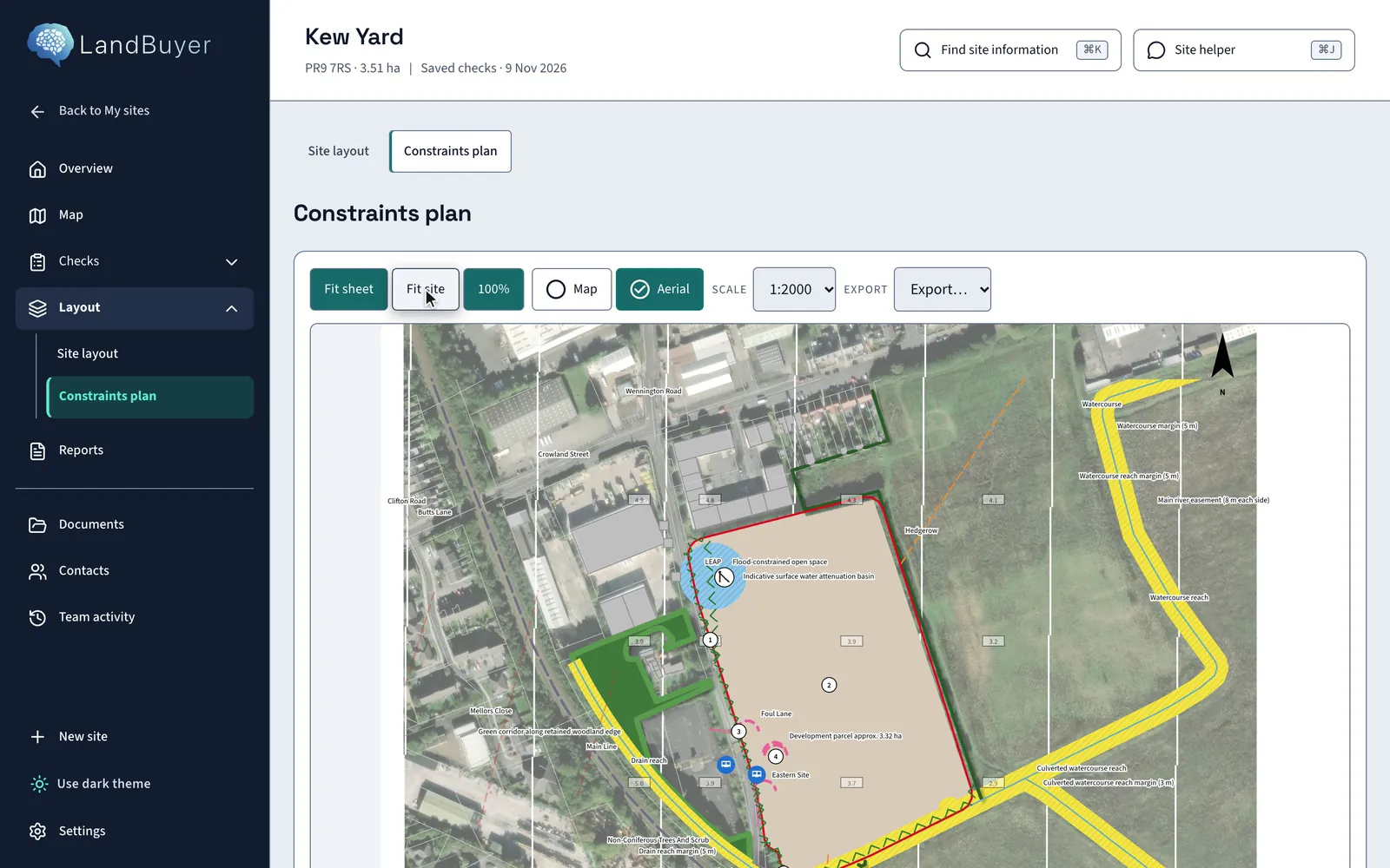
Easements, margins, flood areas, access and services drawn on one scaled sheet, ready for your designer.
In short
LandBuyer AI draws a constraints and opportunities plan for your site from the saved checks. Easement margins, flood areas, hedgerows, access points, visibility splays and service connections sit on one scaled sheet with a key and notes, so your designer starts from the evidence rather than a blank red line.
What it covers
What the constraints plan covers
| Item | Source type | What you see |
|---|---|---|
| Easements and margins | Title registers and mapped watercourses | Protected margins drawn to width, with no built form within them |
| Flood and surface water | Flood maps for planning | Flood zones, surface water risk and an indicative attenuation basin |
| Access | Frontage roads and highways | Potential vehicular access points with visibility splays |
| Services | Utility operators and apparatus | Indicative points of connection to existing services |
| Landscape | Mapped ground cover | Hedgerows to retain, landscape buffers and potential open space |
| Levels | Spot heights | Spot levels across the site, in metres |
On Kew Yard
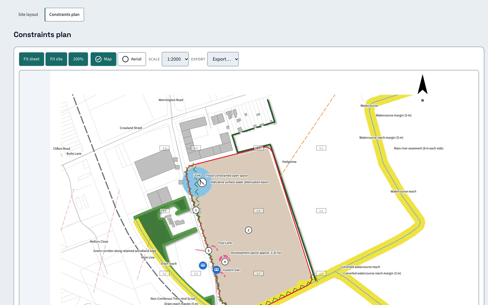
A 3.32 ha development parcel inside a 3.51 ha site
On Kew Yard the plan leaves a development parcel of about 3.32 ha once margins and flood constrained open space are drawn.
AI insight
A 4 metre wide drainage and services strip, reserved by the Transfer dated 9 July 2021, burdens the land. Its position on the title plan would constrain where buildings and levels can sit in the layout.
In the report
From the plan to the layout
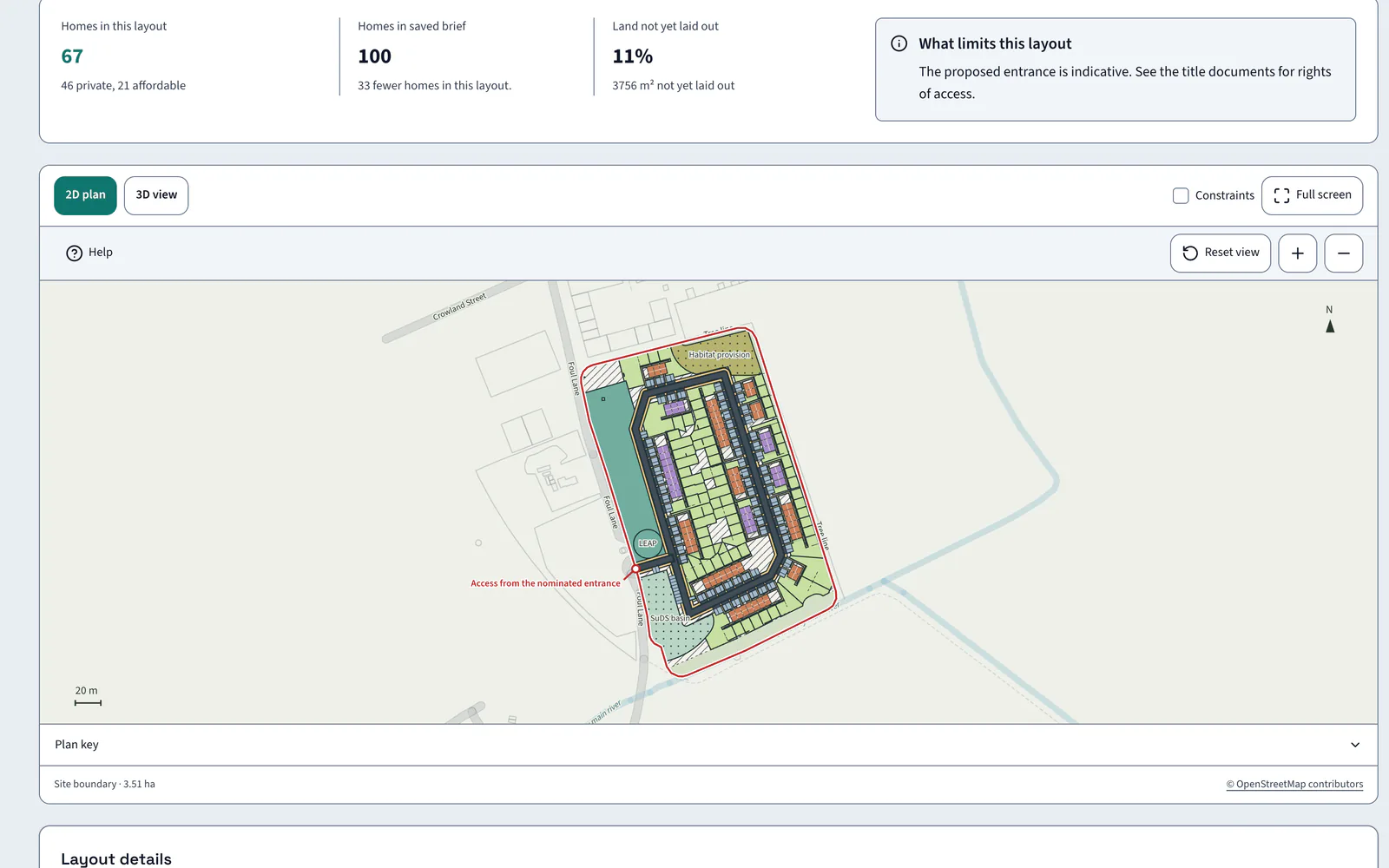
The AI plot builder lays out homes inside the same constraints, so the indicative layout respects every margin on the plan.
FAQ
Constraints plan questions
Short answers to what land teams ask us before a demo.
What is on the constraints plan?
Easement and watercourse margins, flood zones, surface water risk, hedgerows, landscape buffers, access points with visibility splays and points of connection to services, with a key and notes.
Is the plan drawn to scale?
Yes. The Kew Yard plan is drawn at 1:2000 on A3, with a scale bar, north point and drawing number. It is a desktop study, and survey confirms it.
Can our designer use it?
Yes. Download the plan for your designer, who starts from the constraints and opportunities rather than a blank red line.
How is this different from the constraints check?
The constraints check reports the designations that touch the site. The constraints plan draws every constraint and opportunity from all the checks onto one sheet.
Keep exploring